- cross-posted to:
- globalnews@lemmy.zip
- china@sopuli.xyz
Cross-posted from: https://feddit.de/post/10664616
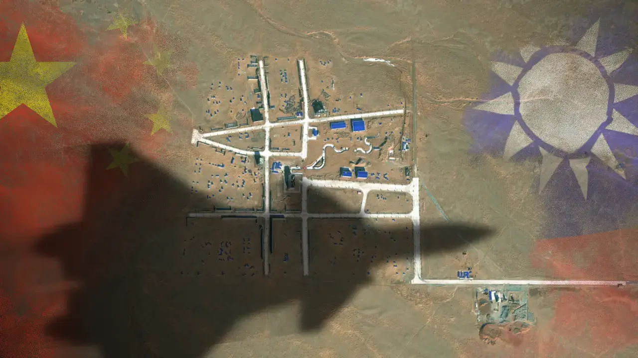
The satellite images reveal a layout of streets strongly resembling the Bo’ai Special Zone, a restricted area in Taipei’s Zhongzheng District that houses Taiwan’s most important state buildings, including the presidential palace, the supreme court, the ministry of justice and the central bank of Taiwan.
The Bo’ai Special Zone is subject to specific regulations, including a strict ban on overflight.

There is a bit of a difference between buikding a realistic looking generic town and, say, building an exact replica of the Kremlin.
There are no “generic towns”; hop onto Google Maps, or even better Google Earth, and check out the distinctly different city layouts throughout the world. Whatever they chose, reveals their plans for action in one or more scenarios.
(somewhat ironically, It’s easier to build a “generic Kremlin”: https://en.m.wikipedia.org/wiki/Kremlin_(fortification) …but with the cold war history, I’d be surprised if the US didn’t build a replica of the Moscow one at some point)
However, I’m more interested in whether they have reached the point of making replicas “invisible to satellites”.