There’s a reason why indigenous people called it Mississippi, a word that came from Ojibwe and Algonquin languages, which are related.
I speak my language of Ojibwe Cree in northern Ontario and it’s very clear for me to understand the word.
Mishi … is a word we use to describe something as big in size
Sipi … is the word for River, a major River, as opposed to a small creek or channel.
In my language and dialect, Mississippi literally translates to just ‘Big River’
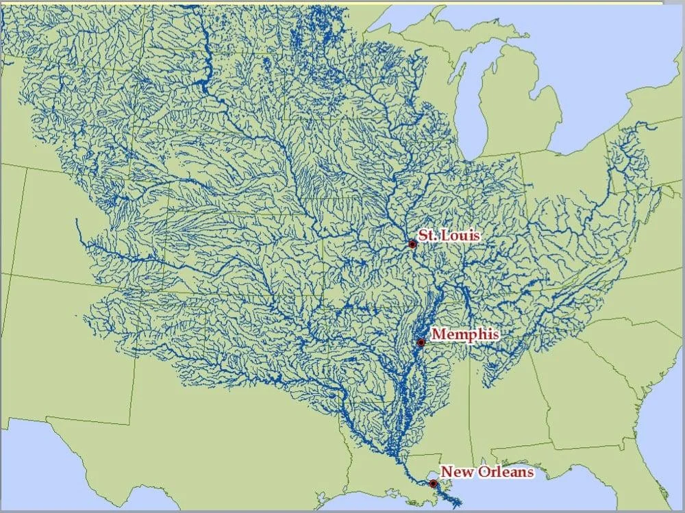
And by the look of this map … it is definitely a ‘Big River’
i guess rockies to the west and appalachia to the east means there is only one way for water shed to flow in middle north america
I imagine there’s other connections not shown near the Great Lakes since this is just showing the dominant south paths, but for the most part it does seem that the inner continent is higher north than south. Which given the geological history also makes sense, with the Canadian shield.
This map is a good reminder of how insignificant international borders can be.
Interesting how it outlines texas pretty well(outside of the little square bit)
deleted by creator
The Red River helps define the northern Texas border.
deleted by creator