
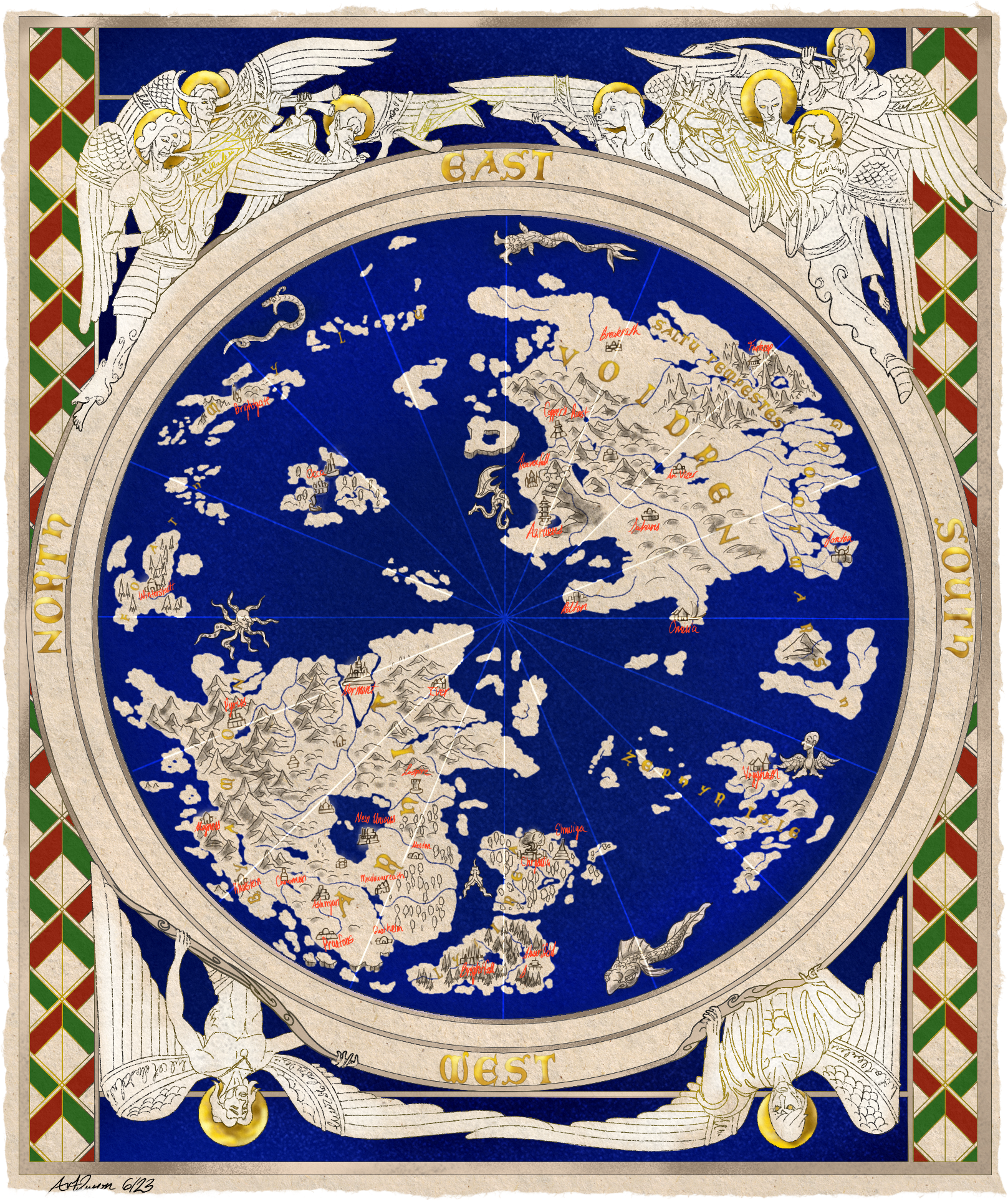
This is a map I made for a D&D game I play in featuring the world setting, Elysia. If I recall the lore correctly for the setting, Elysia was something of a prototype, one that was left unfinished in the end. Like a game that never actually left Beta testing and was released as is (like most modern day AAA games amirite).
The map is highly inspired by a map found in Dover Castle that is a recreation of an older, 12th century map. The Angels that adorn mine are based on those found in D&D, including Deva and Planetars.
The monsters on the map are, likewise, based on those found on that same map. Though with a bit of a slant for the game.
I plan to use this same map frame for other things as well. Maybe for the Eberron or Faerun maps.

Great work on the map! I find the orientation of the cardinal directions very interesting. My first thought was that is how 12th century maps used them, but I couldn’t find any with the cardinal directions on them. What caused you to rotate them like that?
They usually used latin, hebrew, or other languages rather than what we would use, probably. If you check, you may see that they’ve done that. Or it may be one of those things where it was just an assumed orientation.
In the case of using East at the top, it was not uncommon because East is the direction the sun rises. So, you’d orient them east. We use compasses now, but they didn’t necessarily have them back when many of these maps were made. So, the most consistent landmark may have been a star, probably the sun. I know of old maps made by the Hebrews that set Jurusalem at the center, with east as the top as well. I imagine some maps may have even included constellations, though I that’s just a guess, and I have no evidence for it.

That is unbelievably beautiful! Would love to see this and anything else you make over on worldbuilding@lemmy.ml if you ever wanted to post there.
I think I will! Thanks!